Today was our travel day back to Canada. Thank you, Bob, for being my travel companion, my husband, the love of my life.
Day 35 October 7 Exploring Edinburgh Day 2
This morning we bought our morning latte from the Coffee Cave across the street from our hotel room. It was delish!

Our planned walking loop for the day was to start at Arthur’s Seat, 3 kilometers from the hotel. We passed some interesting things on the way.

Born Free animals in the park:


The rocky peak of Arthur’s Seat (251m), carved by ice sheets from the deeply eroded stump of a long-extinct volcano.


We then went to the National Museum of Scotland. IT WAS AMAZING!!


As with our experience in the Scotland Parliament Building, we could not find our way out of the museum. We had to ask an employee how to exit. She said “Follow me. I am going in that direction.” She must be training for Olympic speed walking. We had to jog to keep up with her. Once we found the exit, IT WAS POURING! We were planning our next destination, which was to find Greyfriars Bobby. A man standing next to us (waiting for the rain to stop), overheard us. He came over and explained where to find the statue and the story behind it.

Day 34 October 6 Edinburgh’s Old Town
We started the day by going for breakfast at a local “bench“.

After breakfast, we meandered back to the hotel via the Union Canal promenade.

What is a narrow boat?
https://www.whiltonmarina.co.uk/useful-info/narrowboat-basics.aspx
The Union Canal:
The Union Canal, full name the Edinburgh and Glasgow Union Canal, is a canal in Scotland, running from Falkirk to Edinburgh, constructed to bring minerals, especially coal, to the capital. It was opened in 1822 and was initially successful, but the construction of railways, particularly the Edinburgh and Glasgow Railway, which opened in 1842, diminished its value as a transport medium. It fell into slow commercial decline and was closed to commercial traffic in 1933. It is now in popular use for leisure purposes.


We then started our ascent up to Edinburgh Castle.


Edinburgh Castle has played a pivotal role in Scottish history, both as a royal residence and as a military stronghold. The brooding, black crags of Castle Rock are the very reason for Edinburgh’s existence. This rocky hill was the most easily defended hilltop on the invasion route between England and central Scotland, a route followed by countless armies from the Roman legions in the 1st and 2nd centuries CE to the Jacobite troops of Bonnie Prince Charlie in 1745.


After reaching the castle’s front gate, we began our descent to begin the Royal Mile. The Royal Mile (Scottish Gaelic: Am Mìle Rìoghail)[1] is a succession of streets forming the main thoroughfare of the Old Town of the city of Edinburgh in Scotland. WE explored the main street as well as many alleyways (closes).

The first thing we noticed was this Witches’ Well with its grim history.


We continued our walk and, much to our delight, we came across the Writers’ Museum!
The Writers’ Museum is situated in Lady Stair’s House (1662).


The Writers’ Museum contains manuscripts and memorabilia belonging to three of Scotland’s most famous writers: Robert Burns (1759-1796), Sir Walter Scott (1771-1832), and Robert Louis Stevenson (1850-1894).


After a significant amount of time spend in the Writers’ Museum, we reemerged onto the main route of the Royal Mile.

David Hume Statue:

St Giles’ Cathedral was next.


Paisley Close story:

The Museum of Edinburgh was very impressive!


https://www.royal.uk/royal-residences-palace-holyroodhouse
Across the street from Holyrood Palace is the very modern Scottish Parliament Building.

https://archive2021.parliament.scot/visitandlearn/15807.aspx
The Royal Mile is now complete. Now, we just need to walk back to the beginning…uphill.
Day 33 October 5 Travel day to Edinburgh

Our “hotel” in Kingussie:


We chatted with the hotel owner and he gave us the history of these pods. We thought perhaps they were converted containers, but, no. The hotel had bought these pods at auction. They used to be accommodation for construction workers (at $30 CAD per night) and now the project was complete.
Today was a travel day for us. We decided to stop in at Pitlochry, on our way to our final stop in Scotland, Edinburgh.


We arrived in Edinburgh late afternoon. Paparazzi-Lynn tried to capture the essence of the 3 bridges over the Firth of Forth, while Bob, with his trusty sidekick George Patrick Stewart, GPS for short, manoeuvred through traffic. From an engineering documentation point of view, the visuals are poor, but, perhaps from artistic lens, they might be food for thought.


The three bridges over the Firth of Forth are:
The Queensferry Crossing (2017), Forth Road Bridge (1964), and Forth Bridge (1890).
Some information on the bridges:
https://www.theforthbridges.org/
Day 32 Oct 4 Day trip around Loch Ness

Today our goal was to visit Loch Ness. We headed out from Kingussie and came across Laggam Dam near Tulloch.


The tunnel brought 860,000,000 gallons of water a day to the site drawn from a 303 square mile catchment area.
This concentrated natural water power was channelled down two steel pipelines, falling nearly 183m to the hydro-station below. Here 10 giant generating units each produced 10,000 horse-power to supply the factory with electricity.
We travelled through Loch Lochy to get to Fort Augustus.


We arrived at Fort Augustus.

Fort Augustus would not be known were it not for the Caledonian Canal. And the Caledonian Canal would not exist if it were not for Thomas Telford.
Because today was Bob’s birthday, we stopped into a cafe (a very rare thing!!), for a piece of cake. The walls were covered with Telford information and statistics!! This was right up my alley!!


Some interesting links about Telford:
https://www.visitscotland.com/blog/attractions/thomas-telford-constructions/


Scottish Gaelic is everywhere (as it should be).

Our next stop was Urguhart Castle.


More information about Urquhart Castle and the earlier history of the area.
http://www.aboutscotland.com/ness/urquhart.html
Our last destination for the day was intended to be Inverness, but, the Goddess of Traffic Jams had other ideas. Mid-jam, we decided to abort the mission and head home.


Although the shaft of the Grade B listed Mercat (or Market) Cross is an ancient one, probably dating from the late sixteenth century, the cross was restored in 1900, and at that time Davidson carved the unicorn finial for it (see Gifford 195). The unicorn is the traditional heraldic beast of Scotland. It supports the arms of Inverness.
Day 31 Oct 3 Balmacara to Kingussie

This morning we left our attic home in Balmacara to explore more of the Northern Highlands.

Our first stop was Eilean Donan Castle.


Some additional information about Eilean Donan Castle.
https://www.visitscotland.com/info/see-do/eilean-donan-castle-visitor-centre-p248371
The GPS guided us to our next destination via a farm road through the Morvich area, and we discovered the Caledonian Canal by accident.


Next stop was the Commando Memorial at Spean Bridge.


https://www.undiscoveredscotland.co.uk/speanbridge/commando/index.html
Our next destination was Glenfinnan.

By accident, we came across this church.


Some extra information about the church:
The following photos are of the statue in memory of Bonnie Prince Charlie.


https://www.undiscoveredscotland.co.uk/glenfinnan/monument/index.html
Glenfinnan’s viaduct.

The train actually uses this viaduct on a regular basis.

Our day ended when we arrived in Kingussie for the night.
Day 30 October 2 Daytrip to the Isle of Skye

Today we decided to go castle-hunting on the Isle of Skye. Skye gets its name from old Norse sky-a, meaning “cloud island”, a Viking reference to the often-mist-enshrouded hills.

Our first destination was Portree, where, en route, we saw velvet moors, jagged mountains, sparking lochs, towering sea cliffs, and the Old Man of Storr.


Next we headed to Staffin.


Duntulm Castle was our next destination.


After driving through stunning scenery, we arrived at Duntulm Castle. Once again, we had a castle coffee (and lunch!), made by the resident chef, Bob, on his handy-dandy camp stove extraordinaire!!


Information about the castle:
https://www.thecastlesofscotland.co.uk/the-best-castles/scenic-castles/duntulm-castle/
Then we passed by the port village of Uig.

Next we drove a significant detour to view Dunvegan Castle. The views were incredible!


We finally arrived at Dunvegan, only to find out that we were not able to see the castle unless we paid to go in. This was the first time in Scotland, that we had been able to see the outside of a castle. Usually you have to pay to go inside the building. We were quite disappointed, to say the least. Because Bob drove such a long distance to get there, I think it only appropriate that we include a YouTube video of what we would have taken pictures of.
Bob discovered on his GPS, that there was one more castle we could see on our way home. It proved to be the best one of the day!
Castle Moil


Some information about Castle Moil:
http://www.castlesfortsbattles.co.uk/highland/castle_moil.html
Day 29 October 1 Leckmelm to Balmacara

This morning our first port of call, literally, was Ullapool, a few kilometers north of where we stayed for the night. The name Ullapool is said to be derived from the norse ‘Ulla-Bolstadr’ meaning ‘Ulla’s steading’.


Ullapool Harbour

The following link explains the current Ullapool harbour project:


This is a video of what the Ullapool shorefront looked like in September 2022.

This video captures the essence of Ullapool without all of the port work being done:
Some history of Ullapool:
We then travelled from Ullapool to Dundonnell.


From Dundonnell we went to Aultbea (looking for a coffee spot) and accidently came across an anti-aircraft battery site.


The plaques below answer these questions:


A video about these convoys to Russia and what the sailors experienced:
The following photos were taken en route through the Achnasheen region as we headed to Balmacara for the night.


Day 28 Sept 30 Crask to Lechmelm

Our first destination today was Dunrobin Castle.


A short write up and video about Dunrobin:
http://www.dunrobincastle.co.uk/
Dunrobin Castle is the most northerly of Scotland’s great houses and the largest in the Northern Highlands with 189 rooms. Dunrobin Castle is also one of Britain’s oldest continuously inhabited houses dating back to the early 1300s, home to the Earls and later, the Dukes of Sutherland.


The village of Golspie is only one mile away from Dunrobin. We were looking for a place to make our lattes (usually we find something at a beach), but it was too blustery and blowy, and no privacy.


So we continued looking for the best coffee-making spot. We found it at Dornoch Beach, only a short distance from Golspie. The only challenge was that IT STARTED TO POUR! This was the first time this had happened to us since we started the entire holiday 4 weeks ago!! But, Mother Nature was looking out for us. We found a shelter in which to make coffee. This, too, was a first this holiday.


“A gravestone carries the Scottish ‘ell’ measure which was used on market days for transactions in homespun cloth. Donald Sage recollects Dornoch fairs in his ‘Memorabilia Domestica’ written in 1840.
“The market stance was the churchyard. The evening previous to the market was a busy one. The merchants’ booths or tents were then set up, made of canvas streched upon poles inserted several feet into the ground, even into graves and deep enough to reach the coffins. The fair lasted for two and a half days.”
Fairs and markets were great social as well as commercial occasions in Scottish life. Some idea of the noise, the bustle, and the commotion of these days comes across to us in the paintings of Scottish artists – Sir David Wilkie’s ‘Pitlessie Fair’, James Howe’s ‘Stirling Fair’, Philip’s ‘A Scotch Fair’.
A S Cowper, 1989″


Next we drove through Dingwall, on our way to our Lechmelm, our destination for tonight.

En route to Lechmelm


Day 27 Sept 29 Day trip from Crask to Assynt
We decided to stay a second night at the Crask Inn. This gave us the freedom to explore the nearby Assynt region, knowing supper would be prepared for us at any time that we returned. Assynt is a sparsely populated area in the south-west of Sutherland. (Crask is also in the Sutherland region.) Our guidebook casually mentioned a 23 mile detour off the main NC500 route, B869, which would provide us with wild magnificence and glacier-sculpted hills. Little did we know we would experience 25 degree hill climbs and descents, and be hanging off the edge of cliffs on single lane roads! This is a slight exaggeration,but, this road IS mentioned as a dangerous road in Europe! We found all of this out later, of course. Bob was calm; Lynn was not.
https://www.dangerousroads.org/europe/scotland/3860-b869-drumbeg-road.html

Today was a full day of IMAX meanderings with lots of “oohs” and “ahhhs”! But, as I have been writing this blog entry, and taking time to look beyond the scenery, where and how did and do the people live?
Here are a couple of links to the history of the area:
http://www.theassyntcrofters.co.uk/history/
https://www.irefuteitthus.com/owning-assynt.html
Crask to Achfary.


Achfary to Laxford Bridge


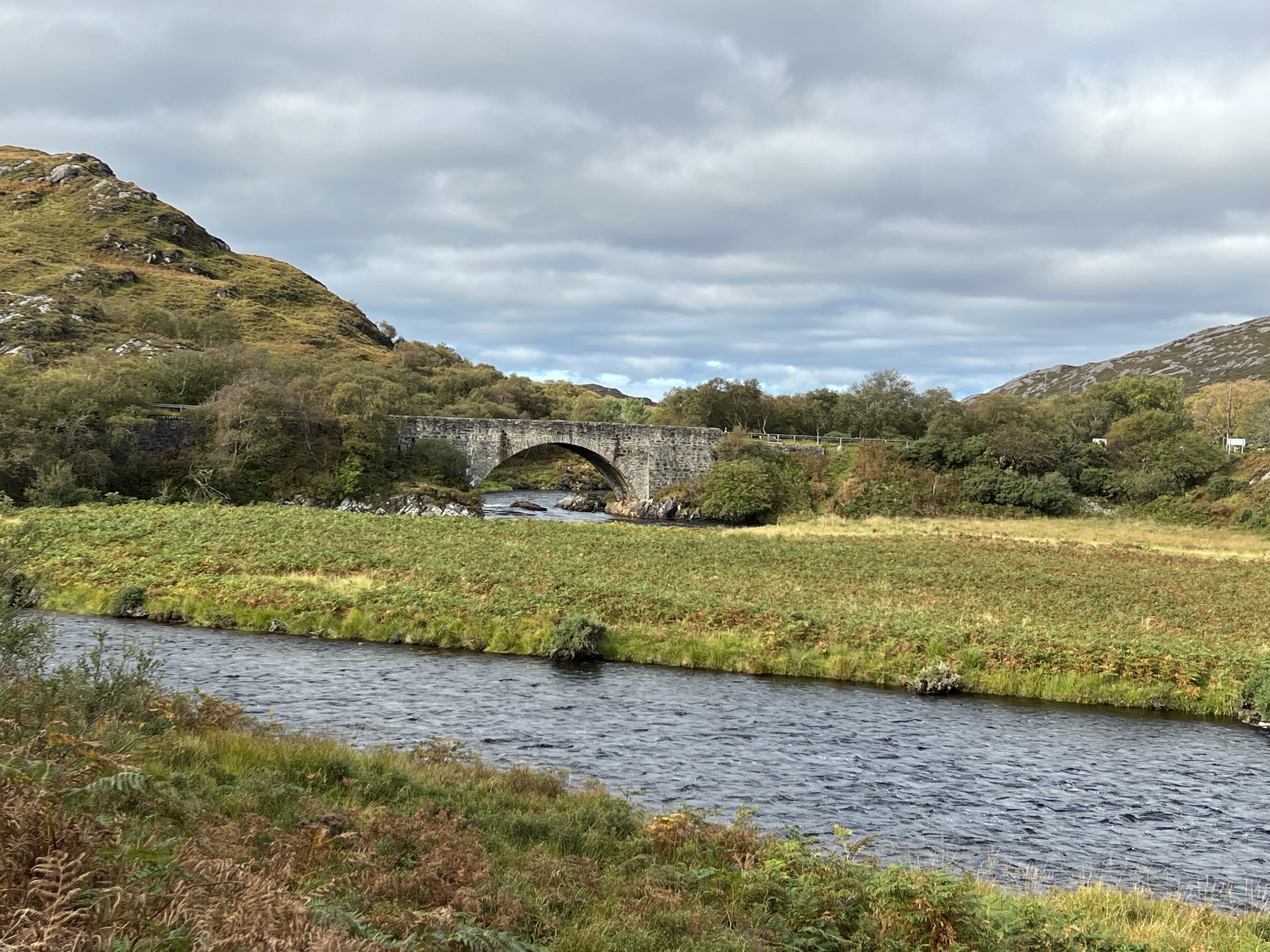
Laxford Bridge
Laxford Bridge to Scourie


Scourie to Drumbeg


Drumbeg to Clachtoll


Some interesting information about the Clachtoll’s geology origins and its social history:
https://www.irefuteitthus.com/owning-assynt.html

Clachtoll to Lochinver


Lochinver to Loch Assynt


Some final visuals and words about Assynt:
https://www.discoverassynt.co.uk/
Back to Crask


